Zoning

Planning and Design Code
The Planning and Design Code applies zones, subzones and overlays (which form spatial layers across South Australia), to specify policies and rules that govern the use and development of a particular area. General Development Policies can also apply but are linked to the type of development proposed rather than its location. The Code includes definitions of land uses and establishes land use classes, as well as administrative definitions. In certain circumstances, the Code allows for the adaption of rules that apply to a zone, subzone or overlay to provide for local variations. This is done through Technical and Numeric Variations.
Source: Guide to the draft revised Phase Three (Urban Areas) Planning and Design Code
Zones
Zones determine how your land can be used or developed. For example, the 'Neighbourhood Zones' (including General Neighbourhood Zone, Suburban Neighbourhood Zone, Established Neighbourhood Zone and Housing Diversity Neighbourhood Zone) typically encourage residential development and primarily envisage housing, and compatible services and facilities. Meanwhile, Employment Zones envisage commercial and industrial activities and Activity Centre Zones provide for shopping, business, and entertainment and recreation facilities.
The policy provisions for a zone apply consistently wherever that zone is designated within the State. These policy provisions may be varied where a subzone, overlay or technical and numeric variation is displayed.
Neighbourhood Zones
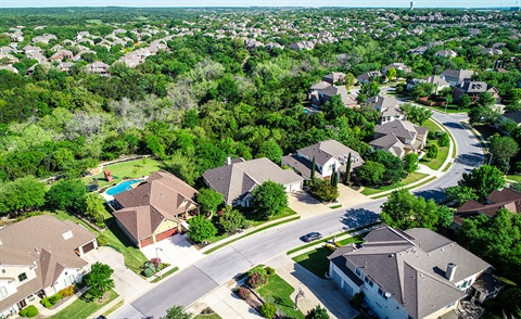
Neighbourhood Zones are used for a range of housing types, styles and densities. Density refers to the number of dwellings allowable per subdivision or allotment. Generally residences are one to three stories in height.
The Code includes a range of policy areas that envisage residential development of different densities. These policy areas can be broadly grouped as follows:
- Established Neighbourhood Zone
- Suburban Neighbourhood Zone
- General Neighbourhood Zone
- Housing Diversity Neighbourhood Zone
- Urban Corridor Zones that support mixed use development.
For full details of policy that affects proposed development, you should consult the Planning and Design Code as the statutory document.
Urban Corridor Zones
The Urban Corridor Zone, along Port Road, Anzac Highway and Henley Beach Road corridors, contains an innovative mix of medium density and high density residential development, together with community and employment land uses. The combination of land uses will vary within these corridors.
Some locations provide for a mix of land uses with ground floor shops, restaurants and offices and upper level residential, while other locations indicate a priority for residential development. Other parts of the zone are intended to have a stronger employment focus.
For full details of policy that affects proposed development you should consult the Planning and Design Code as the statutory document.
Activity Centre Zones
Activity Centre Zones in West Torrens include Local Activity Centre Zone and Suburban Activity Centre Zone. These zones support the development of shops, office, entertainment, health and recreation related uses and other businesses that provide a range of goods and services to the surrounding neighbourhood or district.
Employment Zone
The Employment Zone supports a diverse range of low-impact light industrial, commercial and business activities that complement the role of other zones accommodating significant industrial, shopping and business activities.
Subzones
Policy provisions in a subzone may vary or build upon policy in the associated ‘parent’ zone that is designated for the area. Policies (assessment provisions) in subzones recognise unique variations in the character of a particular part of a zone. Subzones do not contain classification tables or procedural matters tables, but classification tables in the 'parent' zone should be referred to as an indication of the policies and rules that apply in the associated subzone.
Overlays
Overlays are the primary mechanism used to express State Planning Policies in spatial format, as they pick up the specific locations where planning issues of state interest occur. Overlays may span multiple zones and subzones and more than one overlay can apply to the same area. Overlay policies take precedence over other Code policies (e.g. Zone and Subzone policy provisions).
Overlays contain Assessment Provisions and a Procedural Matters table that sets out statutory referrals that apply in the Overlay area.
General development policies
While zones outline the types of development envisaged in an area, General Development Policies broadly relate to how a development should occur. These polices address the functional requirements for a development type or class, such as reducing overshadowing for a multi-storey building. General Development Policies contain only Assessment Provisions but will be linked to specific development types as listed in a zone’s Classification Table.
More information?
To find out more email the Duty Planner in the City Development team at development@wtcc.sa.gov.au or contact us during business hours.